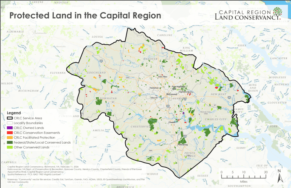
Discover Conserved Lands in Your City & County
Using data available from the Virginia Department of Conservation and Recreation, CRLC partnered with the Richmond Regional Planning District Commission to create a set of maps of conservation easements by locality in the capital region. CRLC is pleased to provide a set of maps updated as of February 2026.
View or download maps for the Cities of Petersburg, Colonial Heights, and Petersburg as well as the Counties of Charles City, Chesterfield, Goochland, Hanover, Henrico, New Kent, and Powhatan.
Additional data and filtering tools can be obtained using DCR’s interactive map available online at vanhde.org/content/map.