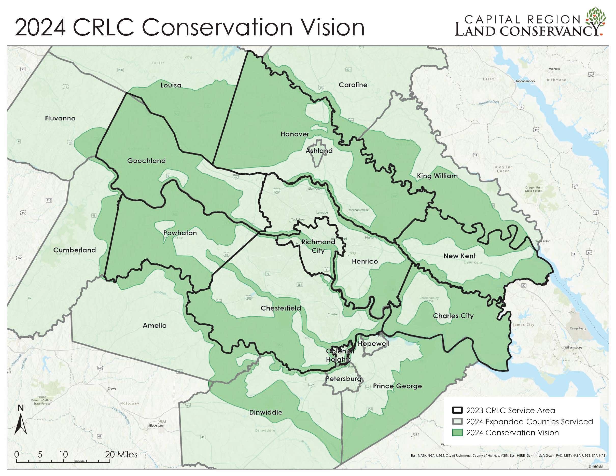
Explore CRLC's Conservation Map Atlas of the Capital Region
You’ll find maps of CRLC’s service area, our conservation vision and a collection of maps of conservation value models produced by CRLC staff. You will also find land use and conversation maps from state offices and local governments across the Capital Region. Conservation related data can be obtained using DCR’s interactive map available online at vanhde.org/content/map.
For maps of protected areas in our region by locality, click the link below: